Back to Oregon
Coast Guide Books
| Introduction:
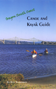
Ive been having a lot of fun over the past few years exploring
places to paddle the inland waters along Oregons South Coast. There are
literally dozens of paddling opportunities -- from lakes and streams in
the Oregon Dunes, to the estuaries of Coos Bay and the Coquille River,
to the lakes and rivers south of Bandon.
|
(includes shipping and handling)
|
A word about the tides
Many of the areas discussed are tide-dependant. You should
obtain a tidebook (available at many local stores) and use the corrections,
if any, for the places where youre paddling. Local newspapers also daily
print tide charts.
When the term "high tide" is used in this book, it refers
to the time of high tide at the Coos or Coquille river channel entrances
at the Pacific Ocean. As you go upriver in the Coos and Coquille estuaries,
the time of high tide time is later in respect to how far upriver you travel.
The farthest reach of tidewater -- called the "head" of tidewater
-- is roughly 30 miles on each river system, and is two to four hours later
than high tide time at the mouths of each river.
If you're paddling on an outgoing tide, be sure you know
where the channel is, since you could get caught on mudflats as the tide
falls. The mudflats consist of sticky ooze thats not much fun to wade
through! This is particularly true in the South Slough, the Coos Bay channel
between the cities of North Bend and Coos Bay, and up Catching Slough.
Most tidal inlets and sloughs have steep embankments that
become exposed as the tide goes out. This makes it difficult to get in
and out of small craft.
I've tried to note the approximate calculations for determining
high tide or low tide, but land observations should always be made prior
to paddling. Each trip as described takes advantage of tides and currents.
In determining tides and currents, I used the software program ChartView
with its companion Tides and Currents.
Put-in/take-out sites and information
Each tour notes the best place to launch, general information
about the direction of the tour, unusual hazards, the length of the trip
and approximate time for the trip.
I used a GPS to determine the distance of each tour, which
is less than the actual shoreline mileage or, in the case of lake paddles,
the shoreline perimeter. Actual perimeter mileage of lakes is shown in
parenthesis when known.
A note about the maps: Because of their small size, the
maps include only the most obvious details. They are correct to scale and
reasonably accurate. I have widened waterways and rivers in some instances
for clarity.
Paddling times are approximate times based on fairly easy paddling,
with time for observing points of interest. Each trip is based on starting
from and returning to the same place unless noted otherwise. However, many
of the trips in the sloughs and bays could be one-way if you have a second
vehicle to work out a shuttle.
I hope you have a safe and enjoyable time exploring the
many watery delights of the Coos Region!
Excerpt:
Heres one of the popular treks on one of the inlets (or sloughs) of Coos Bay:
North Slough (Hauser Channel)
Location: 1 mile north of McCullough Bridge.
Directions: From McCullough Bridge, head north on US 101 for 0.6 mile and turn west on North Spit Causeway, following signs to Oregon Dunes and Horsfall Beach. Drive across the causeway, which crosses a small bridge at its west end. Immediately across the bridge, make a U-turn and park on the south edge of the road. Directly below is a small sandy beach from which you can launch. This launch site can also be used for paddling Haynes Inlet or into the Coos Bay channel.
Facilities/Etc: none.
Launch Site: Small sandy beach.
Length: 7.1 miles round trip
Time: 3+ hours
Precautions: Submerged pilings. Pay close attention to tides and beware of being stranded on a falling tide.
Discussion: Great wetlands paddle. Many birds including eagles, egrets, and herons can be observed. Begin your paddle at approximately the time listed in tide charts for high tide at the Coos Bay channel entrance/ocean beaches, and you will have the incoming tide with you. (See page 2 for important notes about tide times.) Paddle under the vehicle bridge adjacent to the put-in beach and head north. You can stay to the west edge of the slough as you go north, paddling over shallow water. Continue north. The waterway will narrow. Once past the narrowed section, begin to head east toward US 101. The main channel parallels US 101. You can explore the wetlands away from the channel but beware of being caught out on a falling tide. Continue to paddle north until you come to the bridge and tidegate under US 101. Turn around and paddle back at this point. (You could also take out here if you wish, but do so only if it's high tide; the steep embankment makes access difficult during low tide.) If you have timed your trip correctly, the tide will have changed just as you reach the turn-around point, and you'll have the outgoing current with you on the return trip.
Order now! $12.00 (includes shipping and handling)