
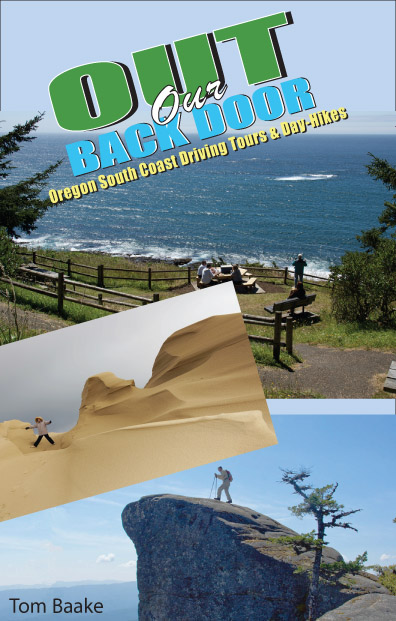
Out Our Back Door By Tom Baake
 ...Yet
it was the curmudgeon in me that originally inspired this book.
Frustrated by crowds at the better-known sites along the coast, I began
checking out some of the back roads and overlooked places. I was
pleasantly surprised to find many quiet little spots to go for a picnic.
...Yet
it was the curmudgeon in me that originally inspired this book.
Frustrated by crowds at the better-known sites along the coast, I began
checking out some of the back roads and overlooked places. I was
pleasantly surprised to find many quiet little spots to go for a picnic.It’s amazing how many interesting things you can do in this region. Ocean beaches, coastal bays and estuaries, the Oregon Dunes, rivers and waterfalls, lakes and forests, the miles of peaceful countryside and old roads . . .
This is great for visitors, of course, and perhaps even better for locals. You don’t really have to make long excursions to see some of the scenic attractions that make Oregon so famous. They’re right here, right in our back yard, “out our back door.” You can sneak out for a little picnic, and be back by the end of the day!
For most of these outings, consider making a day of it, especially if you're inclined to stop occasionally, which I strongly advocate. Needless to say, a full fuel tank and a picnic lunch should be part of the plan. More about logistics in a moment.
As noted earlier, these are intended as day trips, but many can be expanded to longer treks. I’ve included information about camping and other travel options.
While this is a book about back-road tours, it includes trips to the top scenic attractions. It's not fair to overlook them simply because they're popular. They're not always crowded!
Whenever possible, the driving expeditions are made into loops. You don’t necessarily have to complete the loop, of course, and the drives can be approached from either direction. But there's often a reason for my recommendation -- views, for example, or an easier grade "going home."
The exceptions are chapters on local beaches, the Oregon Dunes, and South Slough National Estuarine Research Reserve. For those, a general overview is offered, with emphasis on walking options. Also included are in-town walks, as well as a chapter on hiking trails in the Siskiyou National Forest near Powers.
Some lonely roads are traveled in this book. There are details about road conditions and seasonal access, but you should always check with local sources about current conditions when traveling far afield. Weather-related closures and detours, budget crises and high forest fire danger can affect access.
Oh yes. . . about the weather. First of all, average rainfall is 60 inches per year. It pours down -- or blows in sideways -- during awesome storms in winter and early spring.
Trees are toppled, hillsides collapse, roads are closed, lowland areas are flooded. Yet it hardly rains a drop during July, August and September. We dry out and head to the other extreme: forest fire danger.
Then there’s the wind. During most of the summer, you can count on wind from the north kicking up nearly every afternoon along the coast. Also fog in the mornings and evenings. Just a few miles inland, though, it can be fine and warm and windless. That’s where this book comes in handy, taking you from the chilly coast to an inland picnic where it’s a nice day again.
Best time of year on the coast is Indian Summer, after the first rain or two. The wind has died down, the crowds have thinned out, and the light lies mellow across the land and seascape. There’s still plenty of warm sunshine and picnic opportunities. In winter, too, come interludes of almost balmy weather. The southern Oregon coast is frequently the warmest place in the state in wintertime, and there can be pleasant days of “false spring” that make you forget the weeks of dreary rainfall and gray skies. Indeed, so much of life on the coast is about the weather, and the weather’s always changing.
Road Conditions
All tours in this book have been driven in a standard, two-wheel-drive family sedan. Most trips are on paved roads, sometimes with short stretches of gravel. A few are primarily gravel-road trips. You’re not going to be comfortable negotiating some of the tours in an RV or towing a trailer. Remember that gravel roads get muddy, worse as winter progresses. In summer and fall they get dusty.
Several routes are closed by snow in late fall and winter, and are so identified in the “notes” section at the start of each chapter. THEY SHOULD NOT BE ATTEMPTED WHEN SNOWBOUND!
Most importantly, many tours travel through working forests. That means you may encounter -- as in coming at you head-on -- fully-loaded log trucks, gravel trucks, water trucks, utility trucks, fire trucks, road graders or other heavy equipment. And as with any back-country travel, you'll encounter the occasional fallen rock and downed tree, but roads are rarely blocked for long
The single most important rule to remember is: JUST TAKE IT SLOWLY.
As for maps, those included in this book are all you need to complete the trips, but it never hurts to have more maps. Start with the State of Oregon highway map, then consider one of the privately produced regional maps. Chamber of commerce offices and info centers often have free “tear-off” maps.
U.S. Forest Service offices in Florence, Reedsport, Powers, Gold Beach and Brookings have maps for the Siuslaw and Siskiyou National Forests and for each respective ranger district. The Bureau of Land Management office in North Bend has detailed maps of BLM-managed areas. The combined Siskiyou National Forest/Coos Bay District BLM map is an excellent resource, available from either agency’s offices.
A couple of the tours have their own guidebooks or brochures with maps, available from chamber of commerce offices, visitor information centers, county and state parks offices, the U.S. Forest Service and the Bureau of Land Management.
Map fever has soared to new heights with the use of global positioning satellite (GPS) technology, not to mention the advent of CD-ROM-based mapping software and Internet-available maps. Maps can be found at many places on-line, via government agencies and private sources, some of which are listed in the back of this book. There are errors and glitches in all of them. So I’ve worked hard to make the maps in this book as up-to-date as possible.
The best rule of thumb: when in doubt, stay on main roads. They'll lead you back to civilization. Every effort is made to maintain directional signs in the backcountry, but vandals, target-shooters and souvenir hunters wage a relentless siege.
Once again, remember that you're in a neck of the woods seriously intent on farming trees. Get ready to behold some formidable clearcuts, along with the systematic transformation of mixed-species forest into Douglas fir tree farms. No politics intended, merely a factual note.
That's not to say the grandeur is gone. It's just that it exists these days in what I call islands, and seeking them out takes a bit of venturing in the backcountry.
So let's venture to an island . . . and have a picnic.
Driving Tours and Day Hikes in
Oregon's Coos Region
By Tom Baake
ORDER FOR JUST
$12
includes shipping
2 Guidebooks
for Just
$20
includes shipping
Coast Canoe, Kayak and Stand-up
Paddle Guide
By Ron Wardman and Tom Baake
ORDER FOR JUST
$12
includes shipping
Bike Ride
Guide
By Tom Baake
ORDER FOR JUST
$12
includes shipping
3 Guidebooks
for Just
$30
includes shipping
Take
advantage of our special gift offer!
A
Great Idea For Birthdays,
Special Occasions, and Holidays. We’ll
send a book signed by the
author(s) and inscribed to your friend(s).
This includes a colorful bookmark that indicates the gift has been sent by you. And we’ll even pay for the mailing!
This includes a colorful bookmark that indicates the gift has been sent by you. And we’ll even pay for the mailing!
Check
out Tom Baake's Weekly Column in the South Coast Shopper
HERE!